بيانات جيومكانية دقيقة حتى السنتيمتر، معتمدة وقابلة للتطوير، تتيح اتخاذ قرارات إعمارية مدروسة.


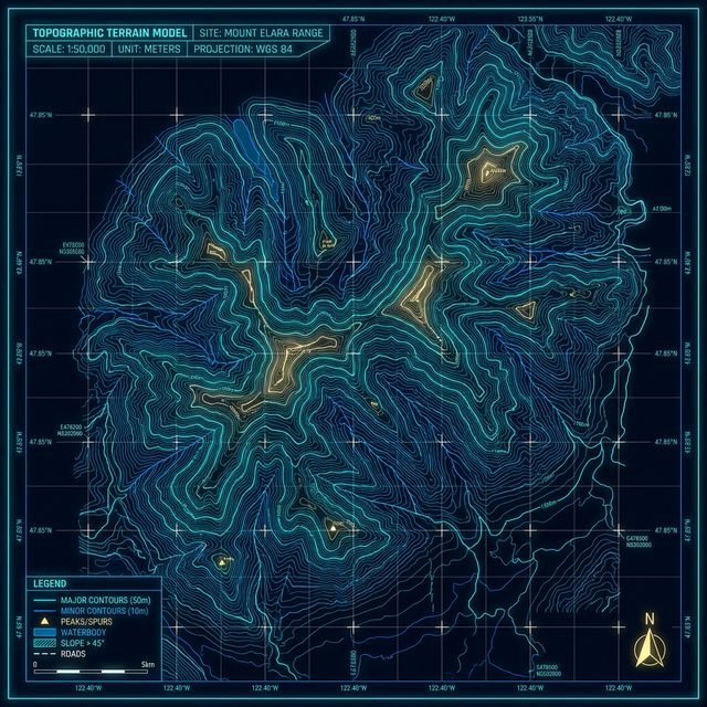
Through millions of mathematically processed laser points, we transform field chaos into contour maps and millimeter-measurable 3D (BIM) models.
Cleansing LiDAR data and extracting solid bare-earth DTMs by surgically filtering out vegetation and obstructions.
Translating data into precise Contour lines ready for direct export into AutoCAD and Civil3D workflows.
Rapid, precise calculations of cut-and-fill volumes for quarries and mega-construction complexes.